08 July 2023
Woodland for Water
March 2023 has seen the establishment of almost 3 hectares of new native woodland and undisturbed water setbacks at Teagasc’s Animal and Grassland Research & Innovation Centre, Moorepark, Co. Cork. John Casey, Forestry Advisor, and Eimear Connery, ASSAP Advisor, tell us more.
There is a wide recognition of the role that riparian and alluvial woodlands have in protecting water and the aquatic ecosystem, and Teagasc’s Forestry & Agricultural Sustainability Support and Advisory Programme (ASSAP) programmes have been to the fore in promoting the planting of such woodlands on farms, where appropriate.
This exciting development will deliver a wide range of significant water-related ecosystem services, including:
- Reduction in sediment mobilisation and runoff into the adjacent river
- Interception of nutrient runoff into the watercourse
- River bank stabilisation
- Food input into the aquatic ecosystem
- Shading / cooling
- Regulation of floodwater
- Riparian restoration
These benefits are in addition to other ecosystem services such as native woodland biodiversity, habitat linkage within the wider landscape, carbon sequestration, amenity and environmental interpretation.
Why plant trees in Moorepark?
The Agricultural Sustainability Support and Advisory Programme (ASSAP) is working with farmers in a free and confidential advisory service to help improve water quality. One of the main challenges to protecting water quality is limiting nutrients (nitrate & phosphate) and sediment from reaching our watercourses. Coliforms & pesticides are the main threats to drinking water.
As part of the ASSAP programme all Teagasc farms have had an ASSAP farm assessment carried out by the local ASSAP advisor to provide knowledge transfer on all aspects of water quality and to identify suitable mitigation measures to help protect water quality.
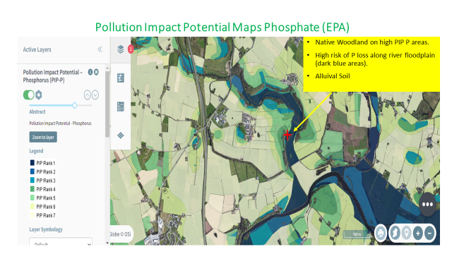
The decision to plant native woodland in Teagasc Moorepark was based on the EPAs Pollution Impact Potential Phosphate Maps (PIPP maps) which identify areas that have a higher risk of Phosphate (P) loss. The farm at Moorepark is predominantly nitrate risky but the fields along by the Funshion river (i.e. the river floodplain) also have a high risk of phosphate loss as shown on the PIP P map below.
The 3 ha area being planted accounts for nearly 5% of the PIP P rank 1 -3 area within the Funshion waterbody. Even though the main nutrient of concern for the waterbody is nitrate, phosphate is also an issue within this waterbody. The phosphate flow pathway identified within the area for planting along with the P index 4 soils making the area an ideal location for native woodland planting. The water setback, an integral part of the woodland project, follows specifications set out in the Environmental Requirements for Afforestation (DAFM, 2016), and forms a strip of undisturbed ground vegetation positioned alongside the river bank.
New Forest Types (FTs)
Under the proposed Forestry Programme 2023- 2027, there will be a range of establishment options & tree species available to landowners, depending on site suitability and the landowners’ objectives. Teagasc will be using the new woodland in Moorepark to highlight three options to farmers considering forestry, with a special focus on the protection of aquatic zones.
Forest Type (FT) 1 – Native Forests– Creation of intimately mixed forest, comprised entirely of native species & prioritised native provenance (mainly alder, oak, willow)
Forest Type (FT) 2 – Forests for Water- Creation of native forest in targeted area, with the specific objective of protecting water from significant pressure.
Native Tree Area (NTA) 2- Creation of native forest for water protection
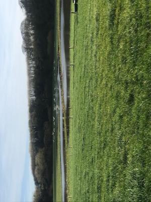
Woodland layout in Moorepark
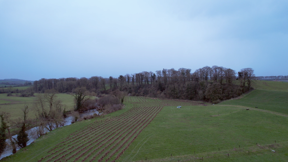
A B C D
Key:
A River
B Permanent undisturbed water setbacks, 10+ metres in width, uncrossed by new drains & largely unplanted. These areas contain setback planting comprising single trees and small groups of suitable native riparian species of trees & shrubs, strategically planted for bank stabilisation, dappled shading & as a food source for aquatic life.
C The new native woodland area is 20 metres or greater in width & uncrossed by new drains. It has been widened at key locations onsite, where adjoining land use, site hydrology & slope increase the vulnerability of receiving waters. A small part (<10%) of the total was allowed to be less than 20 metres in width. This lower limit was used to create a relatively narrow woodland strip along part of the watercourse, without encroaching too greatly on the adjacent agricultural land.
D Surrounding farmland
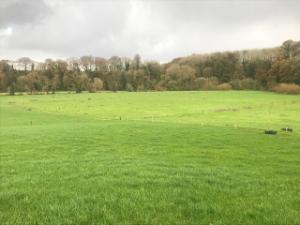
The woodland establishment on a natural floodplain such as the paddock area was feasible since-
- The frequency of flooding and the inundation periods involved will not impede woodland establishment and development; and
- The form of the new woodland along such a sensitive watercourse was developed with input from other statutory bodies such as the EPA & Inland Fisheries Ireland.
Paddock area- 24th November, 2022 Paddock area- 13th January, 2023
Site inputs & future management
The woodland was established with the minimal amount of site inputs (e.g. fertilisers) and disturbance (e.g. cultivation). The focus was on retaining natural site conditions and facilitating the emergence of a native woodland type that would occur naturally in time. Ground preparation was limited to inverted mounding and a small amount of pit planting. Standard fertiliser application is unlikely to arise.
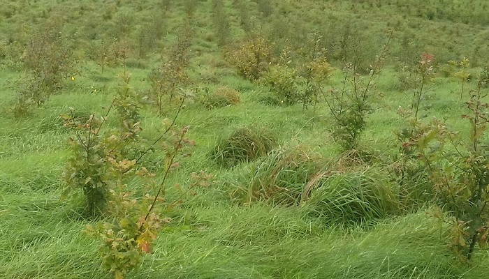
The control of competing vegetation such as grasses, herbaceous plants, bramble and bracken will be vital for the rapid establishment and growth of young trees on such a fertile location. While non-herbicide control (e.g. trampling, grass cutting, etc.) is only realistic on a small scale, any necessary post-planting spot spraying herbicide application will be kept to the minimum required to ensure success. Herbicide application will not be carried out within the water setback or within 20 metres of the aquatic zone.
Water Setback
The water setback was designed to create, at the very outset, an intact and permanent buffer of natural vegetation alongside the aquatic zone, in order to protect water quality and aquatic ecosystems. In effect, the water setback breaks the ‘pathway’ between the source of possible pollution and the receiving watercourse. In the context of native woodland planting, the water setback compliments the protective role of emerging native woodland, which will be managed according to close-to-nature silviculture, principally for biodiversity.
Appropriate tree planting within the water setback will deliver direct in-stream benefits such as bank stabilisation, cooling / shading, and food drop into the aquatic ecosystem, and will create further habitat diversity within the setback. The protective function of the setback will be maintained by leaving this area undisturbed, excluding machine traffic, and allowing a mosaic of natural ground vegetation to develop.
Conclusion
Publicly available maps on www.catchments.ie are a very useful tool for all farmers to identify the high risk areas on their farm for potential nutrient loss and put suitable mitigation measures in place. Potentially every farm has an area that would be suitable for planting of native trees particularly if it can be incorporated with a phosphate flow pathway to help break the pathway of overland flow. The aim is to slow the flow, allow the deposition of sediment and associated nutrients and also to encourage the uptake of nutrients by growing vegetation.
Substantial funding has been earmarked for the Forests for Water measure under the new Forestry Programme 2023- 2027, including a proposed grant of €6,744/ ha to establish the woodland and an 20 year annual premium of €1,412/ ha for farmers. It is very important to consult with Teagasc advisors before planting takes place to ensure that it is the best fit for your farm. Contact details for your local Teagasc forestry development officer can be found at Staff / Contact Us – Teagasc | Agriculture and Food Development Authority