Teagasc and GSI strengthen scientific partnership through new Memorandum of Understanding.
Teagasc and the Geological Survey of Ireland (GSI) deepened their long-standing relationship and successful scientific collaboration by signing a Memorandum of Understanding (MoU) today, Wednesday 8 July. The MoU was signed by Koen Verbruggen, Director of GSI and Professor Frank O’Mara, Teagasc Director, at Teagasc Johnstown Castle, County Wexford.
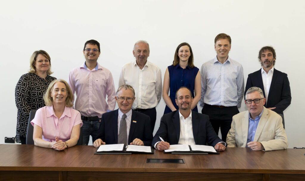
Pictured: (L–R): Front row: Dr Karen Daly, Teagasc; Professor Frank O’Mara, Teagasc Director; Koen Verbruggen, GSI Director; and Ray Scanlon, GSI. Back row: Dr Lillian O’Sullivan, Teagasc; Dr Felipe Bachion de Santana, Teagasc; Professor Pat Dillon, Teagasc; Victoria Lowe, GSI; Dr Raymond Kelly, Teagasc; and Dr Réamonn Fealy, Teagasc.
Speaking at the event, Professor Frank O’Mara said; “The combined scientific expertise between Teagasc and GSI has produced high quality scientific publications and impactful research that has generated new knowledge and technologies for Irish agricultural soils, and the collaboration has delivered additional value from the state’s investment. We look forward to building on this success in the next phase of our collaboration.”
Director of GSI, Koen Verbruggen highlighted the successful scientific partnership with Teagasc has broadened the use of the GSI’s Tellus data to have applications in agricultural research and technology transfer, and this new phase will see both organisations further our understanding of soil health and work jointly to support Government to inform the implementation of the EU Soil Monitoring and Resilience Directive.
Terra Soil is a collaborative research project between DCEE/GSI and Teagasc that combines GSI’s data from the Tellus Programme with soil spectral libraries from Teagasc, coupled with expertise from both organisations to develop outputs to support policy and practice change. The first phase of Terra Soil (2018-2024) developed spectral libraries and soil geochemical indicators for the Northern half of Ireland using Tellus soil archives, geostatistical and spectral models. The second phase of this work aims to derive data and products for the Southern half of the country now that Tellus has completed its ground survey. This next phase of collaboration will use the soil archive to derive new data and spectral libraries and will merge these to build a national picture of soil descriptors and indicators of soil health for sustainable soil management.