ReWet: Facilitating water table management on carbon rich soils
 The ReWet project is investigating the application and impact of water table management on carbon-rich soils. The project focuses on raising water tables on drained peat soils, evaluating the feasibility of rewetting measures, their environmental benefits, and their impacts on surrounding landscapes.
Objectives
- Establish the suitability of lands for rewetting and identify the optimum locations for rewetting efforts.
- Identify artificial drainage features and design efficient methods to undermine these effectively.
- Quantify the impacts on field-scale hydrology.
- Measure impacts on the hydrology of surrounding lands.
- Evaluate the benefits in emission reduction, biodiversity and wider ecosystem services, and appraise land use options in rewetted areas.
Actions
13 sites have been identified around Ireland in collaboration with European Innovation Projects (EIP), Biodiversity projects and the National Agricultural Soil Carbon Observatory (NASCO). These sites are all unique, with different agricultural management, topography, drainage features and peat/soil type. Sites range in size from 1 to 2.5 hectares and have been selected to capture the diversity of carbon-rich agricultural landscapes.
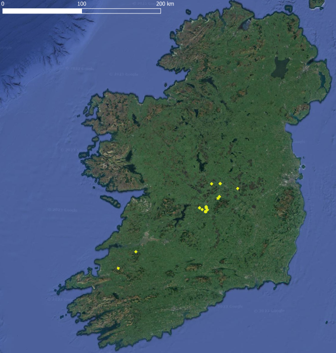
Each site has been instrumented to monitor the effects of water table management. Monitoring includes soil moisture probes, water table monitoring wells, and peat depth measurements. Rewetting interventions have been implemented on selected sections of each site through drain blocking and damming using temporary plastic dams, allowing researchers to evaluate the effectiveness of different water management approaches under field conditions.
Soil sampling has also been undertaken at each site. Soil cores are extracted and analysed in the lab to classify peat type and determine; mineral content, pH, bulk density, carbon content, and other key indicators.
Geophysics methods will be used to map and monitor the extent of peat soil and the success of rewetting across the sites. Methods include ground based electrical methods and Drone based photogrammetry and radiometric measurements.
Project Partners
- Eve Daly, University of Galway
- Mark Healy, University of Galway
- Hilary Pierce, PhD Candidate, University of Galway
- Dave O’Leary, Post Doctoral Researcher, Teagasc